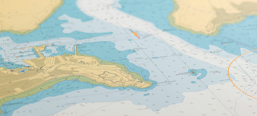
A hundred years ago, navigation was half superstition, half instinct. You could tell a sailor’s experience by the way they stared at the horizon—measuring wind, scent, and silence. Maps were paper. Salt-stained. Torn at the edges. Each update pencilled in during storms, hands trembling against the roll of the ship. Now? It’s data. Pure, glowing, endless. The ocean is still there, wild and wide, but the way we see it has changed completely. At the centre of this quiet revolution sits nautical charts online, shifting how mariners think, plan, and survive.
From the Smell of Salt to the Click of a Mouse
There used to be a kind of poetry in navigation. No buttons, no screens—just stars and instinct. You’d hold your breath to feel the shift of air before dawn. You knew the tide by the way the water whispered at the hull. Those old sailors had no algorithm. Only memory.
Paper charts ruled the wheelhouse then. They were cumbersome, unreliable, and sacred. Each crease told a story—storms endured, routes corrected, landfalls found. Then came the first digital charts. Clumsy, slow. But different. Suddenly, maps weren’t just drawings; they were alive. You could zoom, layer, measure. You could see not only where you were but also what moved beneath you. Depths became visible. Data replaced instinct—or maybe, sharpened it.
Digital Charts as Living Ecosystems
Modern digital charts breathe in rhythm with the sea. They don’t sit still. Every shoal that shifts, every buoy relocated, every channel dredged—it’s all captured and updated faster than ink could ever dream. Some refresh daily, others every hour. NOAA’s versions even link straight to satellites and survey vessels, syncing what’s below with what’s above.
The result? Knowledge that moves. Commercial captains use it to trim their fuel costs, cutting tiny inefficiencies that add up to survival in harsh economies. Weekend sailors rely on it to slip safely between reefs invisible to the naked eye. Scientists map seabeds in high definition, comparing data sets from decades apart. You begin to realise: nautical charts online are less tools and more organisms—alive, evolving, connected.
It’s not about direction anymore. It’s about awareness. The sea used to be a mystery; now it’s a language. And digital charts – they’re how we read it.
The Mind of the Modern Navigator
The sea plays tricks on human perception. It’s too open, too empty, and the brain craves edges. That’s why charts matter—they draw order on chaos. But digital navigation shifts the relationship. The mariner’s gaze no longer rises to stars but drops to screens. Depth lines become landscapes; colour gradients, stories.
It changes psychology. A sailor used to think in landmarks: headlands, lights, waves breaking over hidden rocks. Now the thinking is layered. Numbers. Tides. Satellites. Zoom out, and the coastline shrinks into symbols; zoom in, and each inlet pulses with detail you’d never notice from deck height. It’s a new kind of intimacy with the sea—remote, yet sharper.
There’s danger in that comfort, though. Overtrust. Charts can seduce with precision. Mariners must remember: even the best data lags behind reality. The ocean moves faster than updates.
What the Old Salts Still Understand
Talk to a veteran sailor, one who’s crossed oceans without electronics, and you’ll hear scepticism under their respect. They’ll nod at technology but keep a paper chart tucked somewhere dry. Not nostalgia—discipline. They know that digital charts show what’s been mapped, not what’s there right now. Floating logs, lost containers, rogue waves—no system predicts those.
One captain once said, “If you stop checking the sky because the screen looks fine, you’re not a sailor anymore—you’re a passenger.” There’s wisdom in that. Digital precision should sharpen your senses, not dull them. Good navigation still lives in the space between map and mind.
That’s the paradox. Progress doesn’t erase seamanship; it refines it. The skill is not in pressing buttons—it’s in knowing when not to trust what they show.
The Ocean, Still Unfinished
Every new chart feels like progress, but the sea keeps reminding us: it cannot be fully known. Technology draws boundaries; the water blurs them again. Beneath each contour, things shift—currents carve, sediment moves, wrecks emerge and vanish. We chase precision, and the sea stays indifferent.
That’s the quiet beauty of it. The more exact our maps, the more mysterious the ocean becomes. You can spend a lifetime plotting it and never master it. The horizon remains what it’s always been—a dare.
Maybe that’s the point. Maybe the charts, the screens, the satellites—they’re not about control. They’re about connection. A dialogue between human curiosity and an untamable world.
And so, using nautical charts online isn’t just modern navigation—it’s our latest way of listening to the deep. Every pixel, every depth sound, every coordinate reminds us that while we’ve mapped the surface, the ocean still keeps its secrets.


